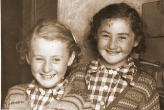
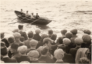
Above: Friendly Faces, probably 1940s.                     Dingle, probably 1940s.                           Námhóg raceing, Ballydavid, 1940s                         
                                                            

                                                                             You are reading - County Kerry.     Home


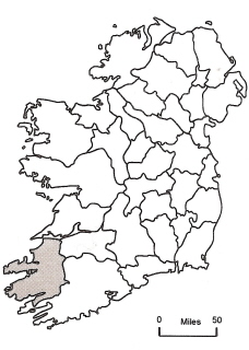
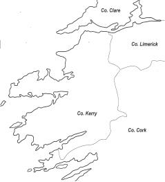
County Kerry is located in the extreme south-west of Ireland and covers an area of c. 4,747 square kilometres (c. 1,832 square miles). Bordered on the east by county Cork and on the northeast by county Limerick, it is one of the more geographically isolated counties. To the north, across the Shannon Estuary, lies county Clare. County Kerry’s highly indented coastline stretches for over 1,000 kilometres (62 miles) and fronts the Atlantic Ocean. The Dingle, Iveragh and Beara Peninsulas interrupt the coastline along its length.

Rising sharply from the low-lying land around Tralee town, the Dingle Peninsula is the most northerly of the three peninsulas. It runs westwards for almost 65 kilometres (40 miles) and is largely covered by mountains and deep valleys, with Mount Brandon on the north rising to 953 metres (c. 3,126 feet). At the extreme western tip of the peninsula there is some low-lying land.


     Above. Mount Brandon Ridge.

The Iveragh Peninsula is around c. 48 kilometres (30 miles) long and c. 24 kilometres (15 miles) wide. On the north are the Macgillycuddy’s Reeks. This glaciated sandstone mountain range contains Ireland’s highest peak, Carrauntuohill, which rises to 1041 metres (c. 3,141 feet). The long line of mountains on the south side of the peninsula contains twenty summits of more than c. 61metres (2,000 feet). 

The Bearra Peninsula, is the most southerly of the three peninsulas and is shared between counties Kerry and Cork. It lies between the Kenmare River and Bantry Bay and contains the Caha Mountain range, many of the summits of which rise to over 61 metres (2,000 feet).


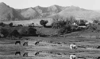
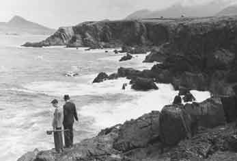
County Kerry is famous for its beautiful scenery, composed of rugged high mountains, picturesque lakes and coastal inlets.


     Smerwick, Ballyferriter. 

Kerry's climate is influenced by its maritime location, as the Gulf Stream brings warm air and water up from the Gulf of Mexico. The county experiences considerable rainfall, especially in the southern, mountainous portion of the county. 

Tralee serves as the county town, while Killarney has served as the principal tourist destination since the mid eighteenth century. Other towns include Listowel in the north, Castleisland to the southeast of Tralee, Kenmare in the south, Cahirciveen in the southwest and Dingle in the west. Kerry airport is situated at Farranfore, while a regular train service connects Tralee and Killarney with Dublin and Cork.

The population of Kerry is over 125,000, and is largely concentrated in, or around, the urban centres. Apart from tourism, agriculture is a major employer within the county, while manufacturing, fishing and forestry, are also represented.    


        Above: Minding the sheep, Spring 1953.

                               Home


Make a Free Website with Yola.